Cartographic Portfolio
Below you will find examples of my cartographic work that I have created throughout my work experience and for fun. Since earning my degree, I have become passionate about cartography and have spent time developing my advanced cartographic techniques. In 2025, I completed my first freelance cartography project for Upcountry Steamboat and have also started selling ski resort maps on my Etsy page. Click on the image of a map to view it in a new tab.
I created these maps as gifts for my family and used it as an opportunity to play around with symbolizing elevation data in different ways. I combined a hypsometric tint color scheme on the DEM, hillshade, and imagery using layer blending techniques to create these two maps.
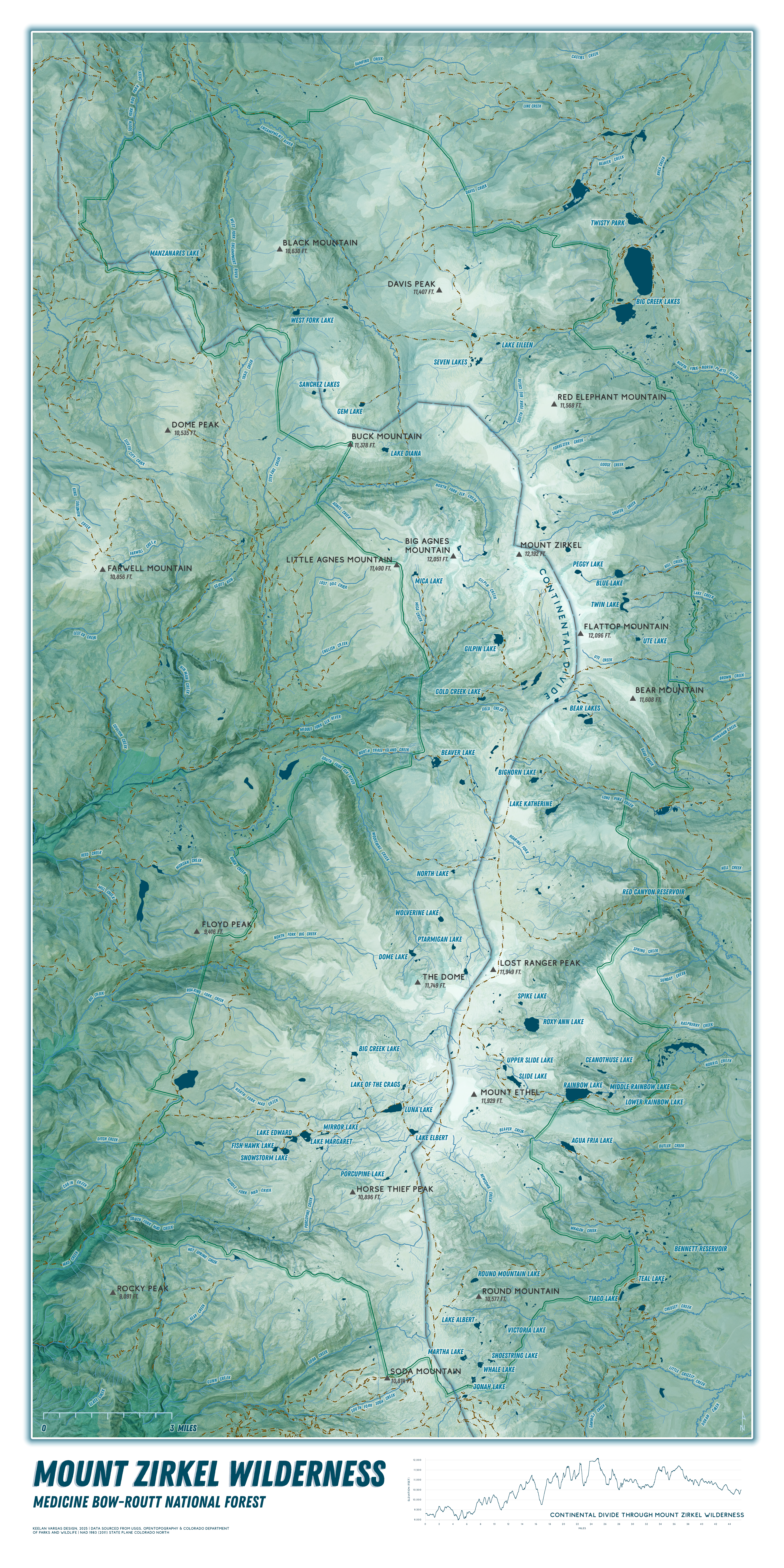
Mount Zirkel Wilderness
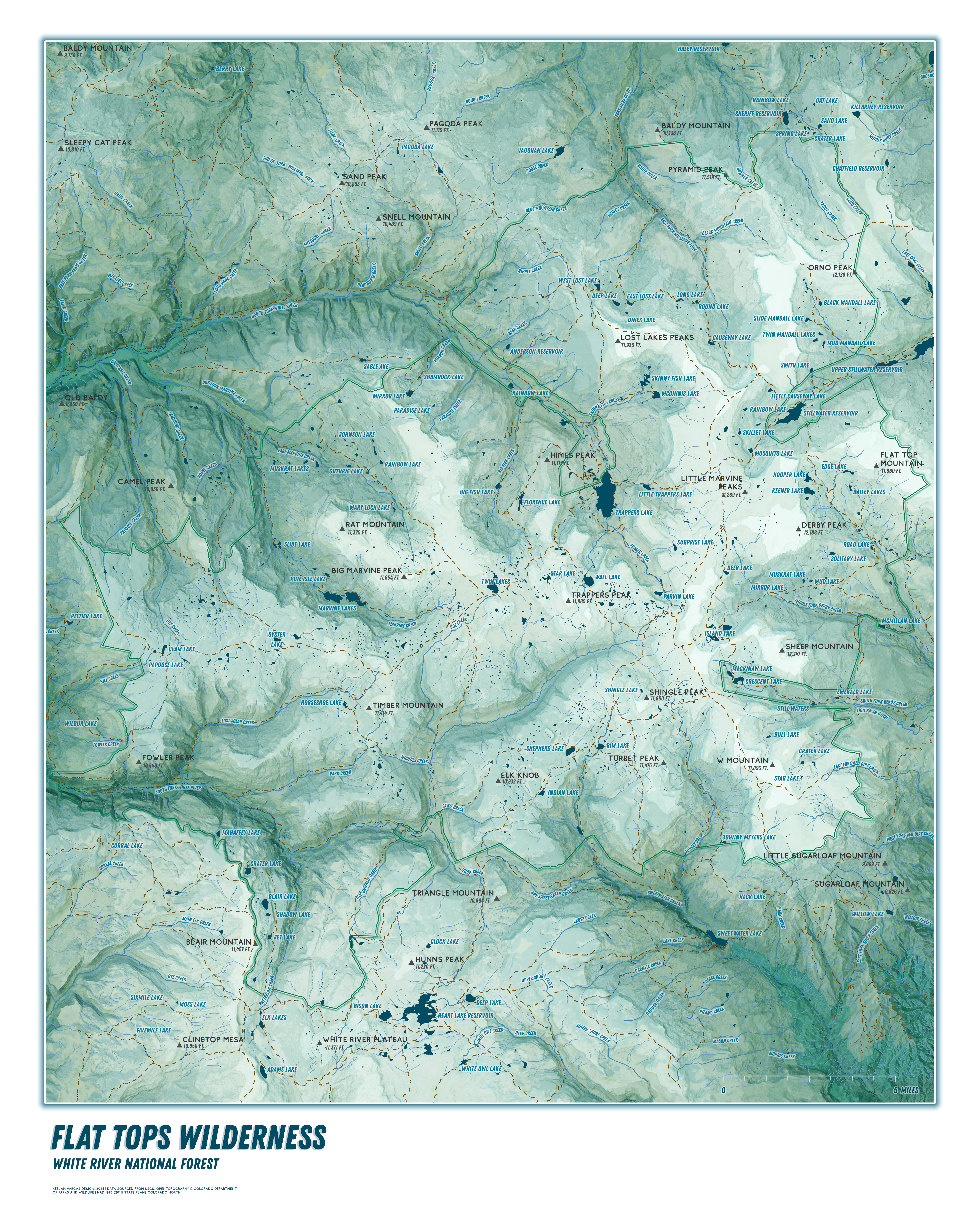
Flat Tops Wilderness
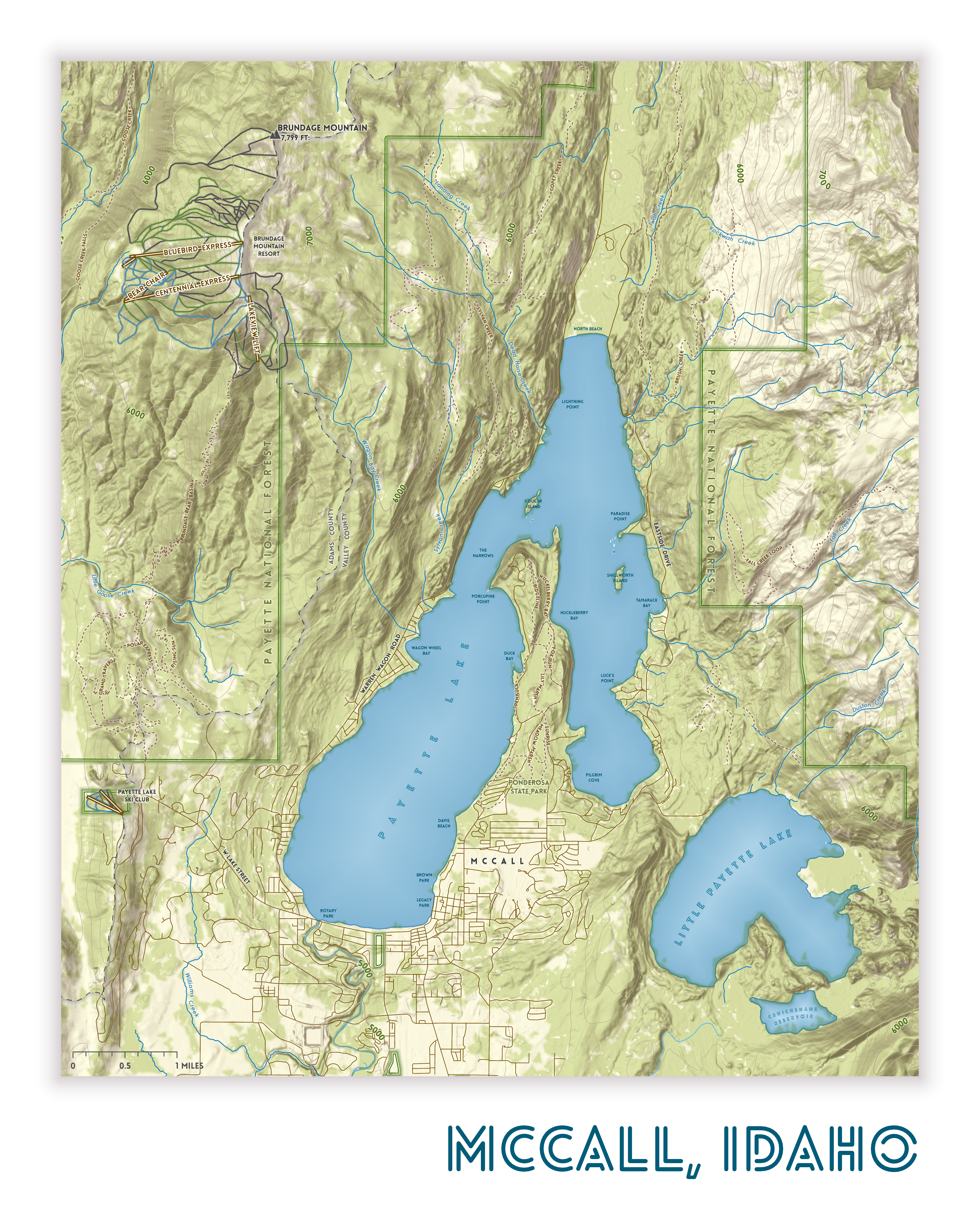
McCall, Idaho
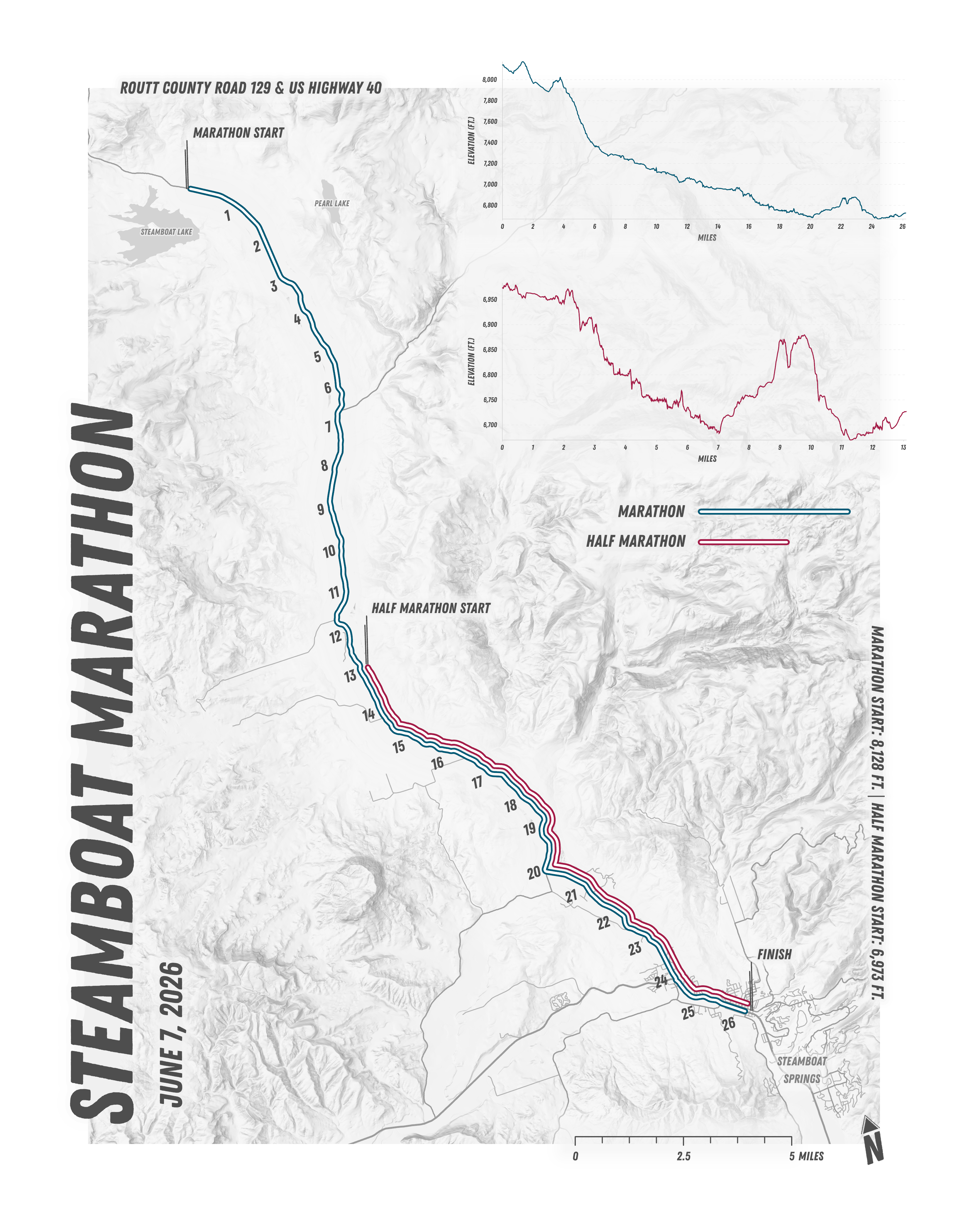
Steamboat Marathon Map
I created this map of the Steamboat Marathon course to showcase the route and elevation change in a more artistic way.
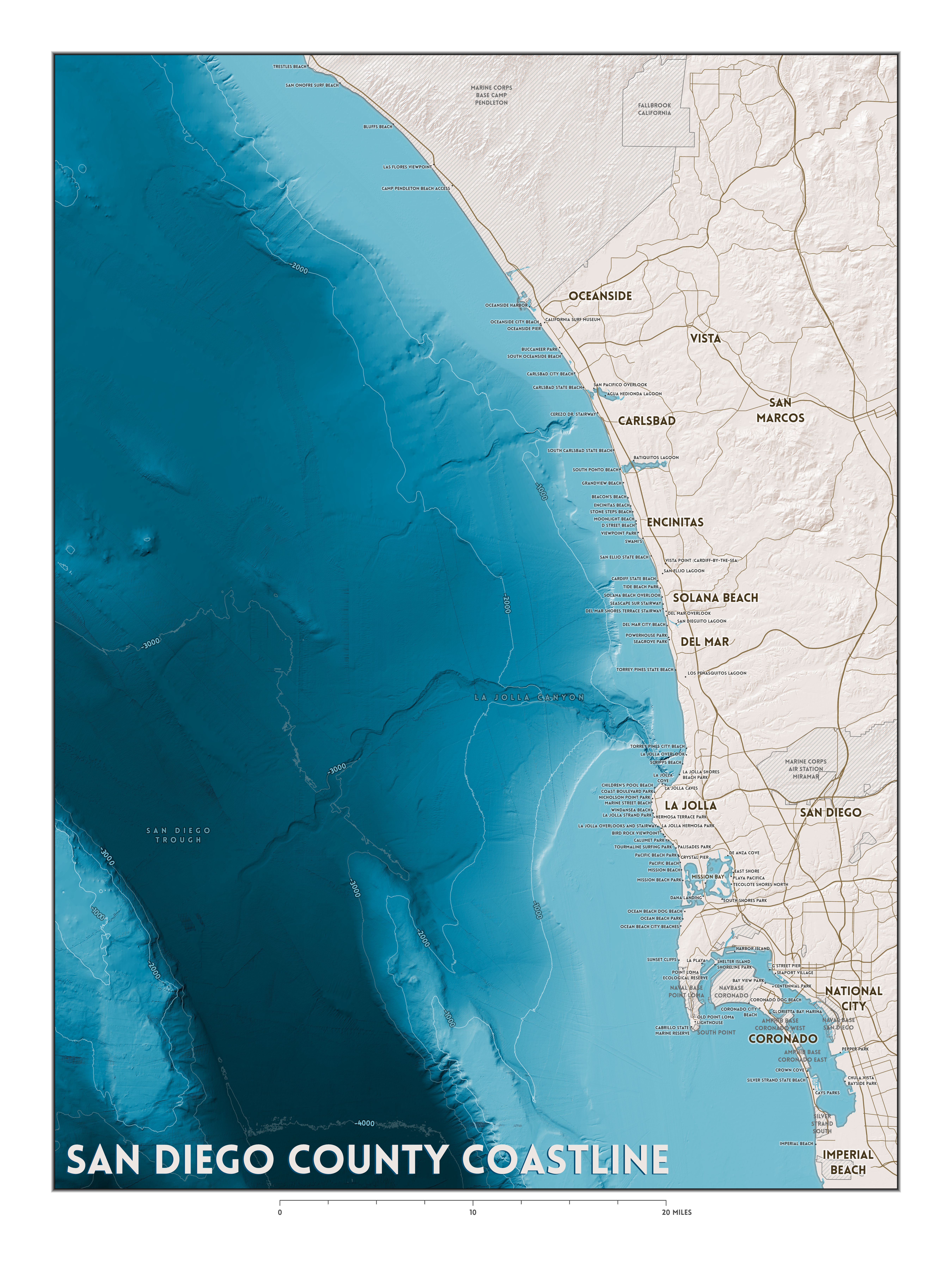
San Diego County Coastline and Bathymetry
This map was created as a personal project to display in my home. I used bathymetric data from NOAA and coastline data from the California State Geoportal.
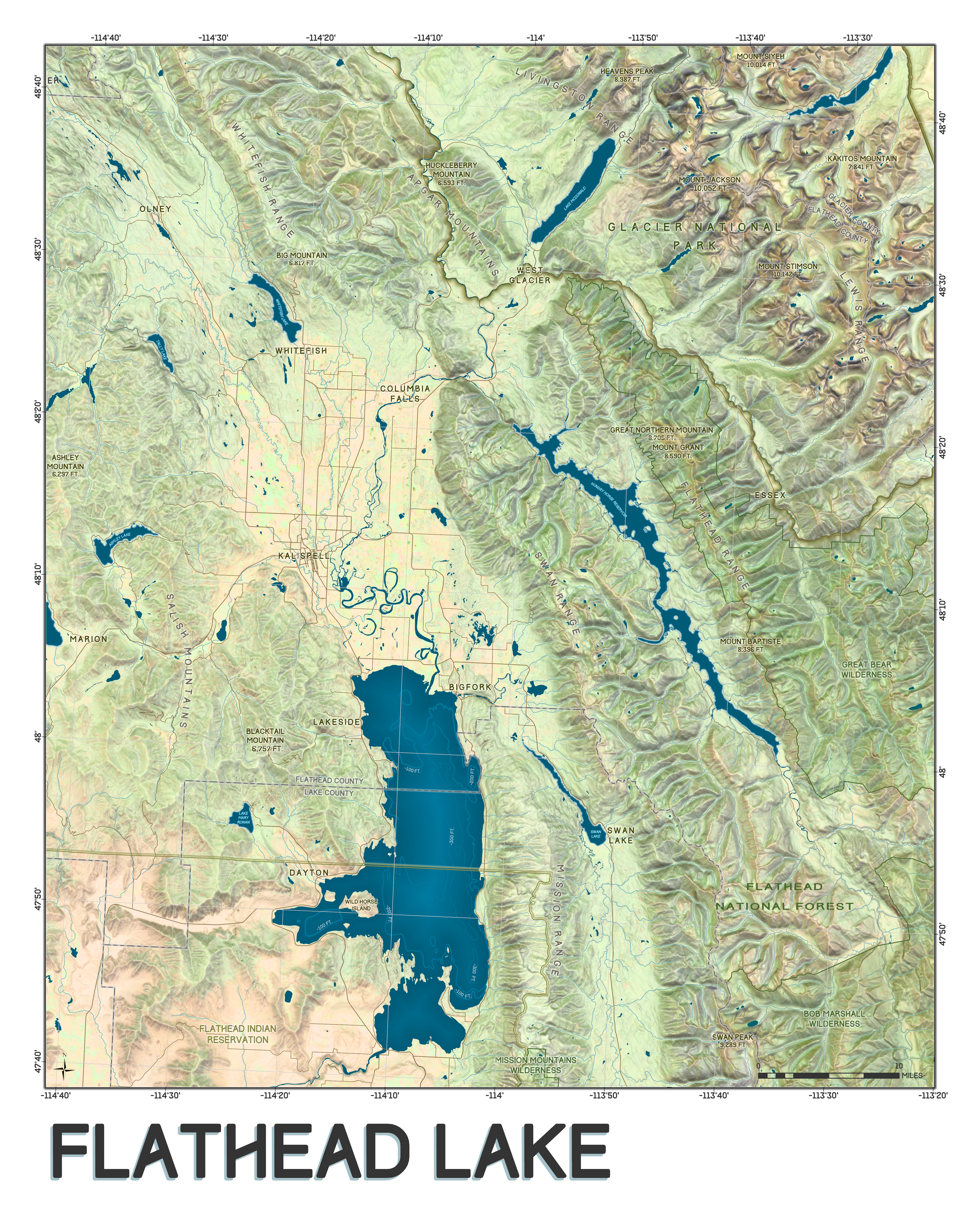
Flathead Lake and Surrounding Area
This map was commissioned by a friend as a Christmas gift to his family who have own a lake house on Flathead Lake and have spent time with family there for decades. The original map also included points of interest and family landmarks, but I have removed those for privacy.
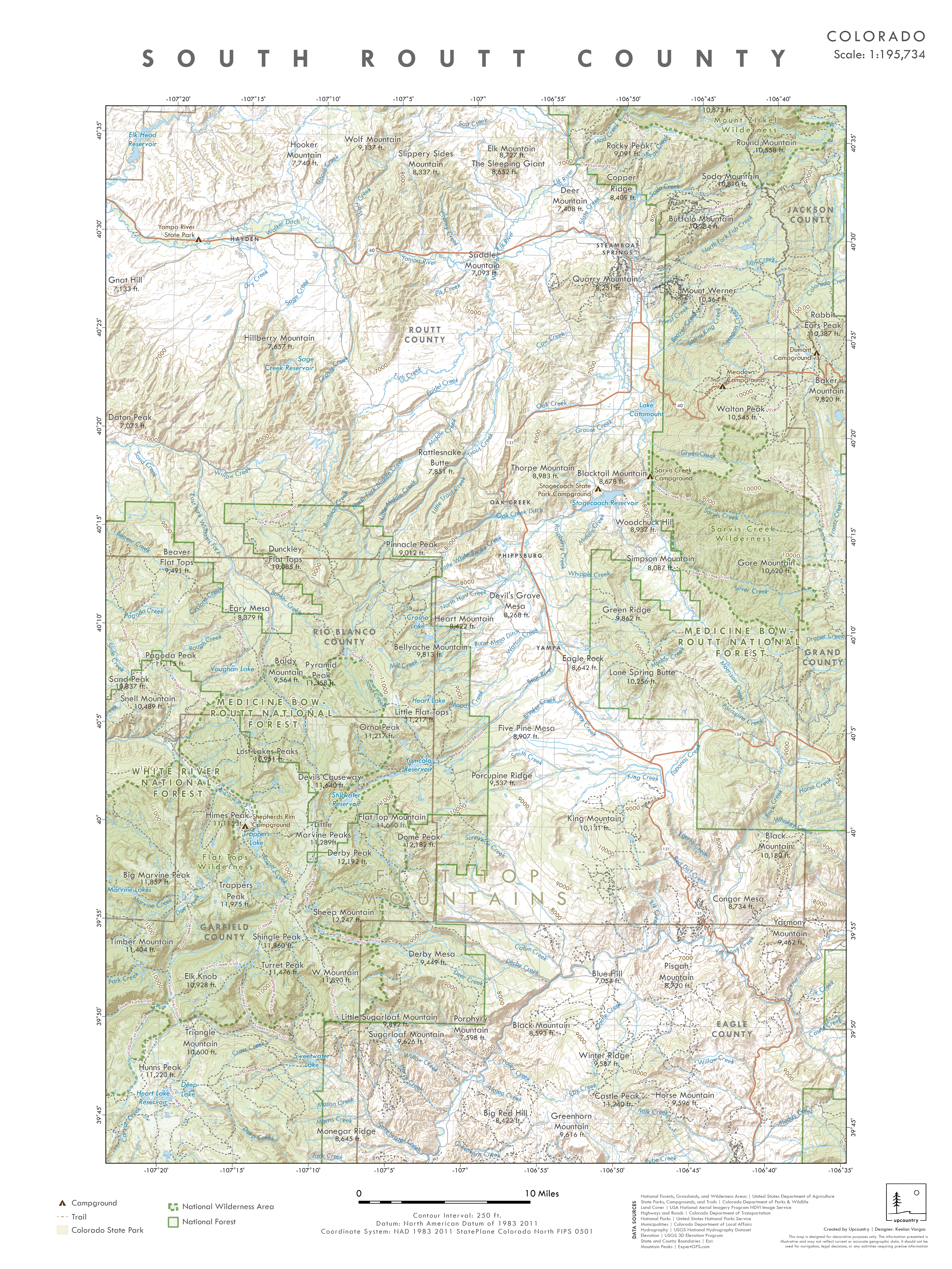
Colorado Maps for Upcountry Steamboat
I was commissioned by Upcountry Steamboat, a local apparel and home goods store, to create a series of maps of Routt County. The maps include the northern and southern areas of Routt County, the State of Colorado, and Steamboat Springs. The maps were created in a similar style and color pallette meant to tie together the maps as a full series.
North Routt County, Colorado

South Routt County, Colorado
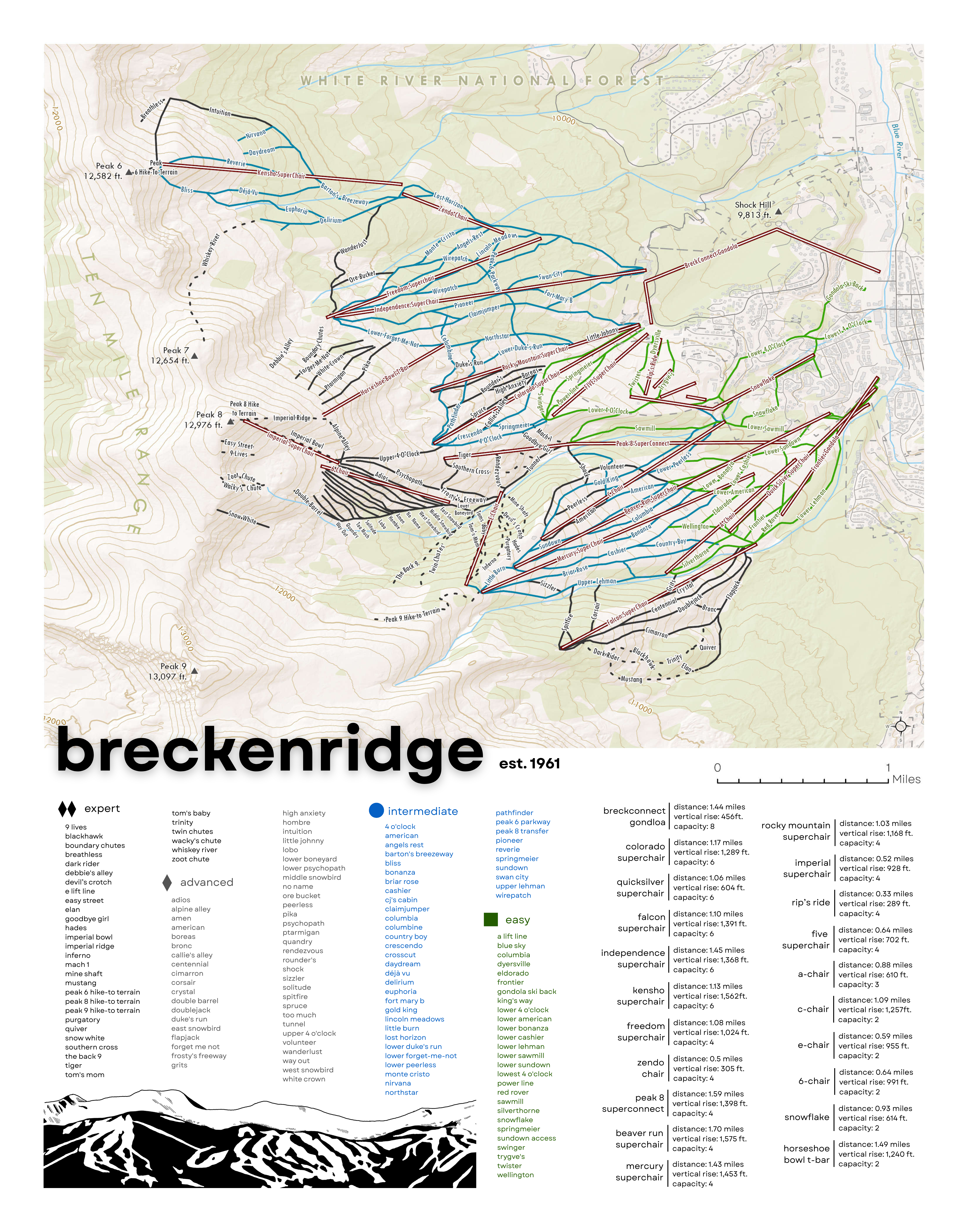
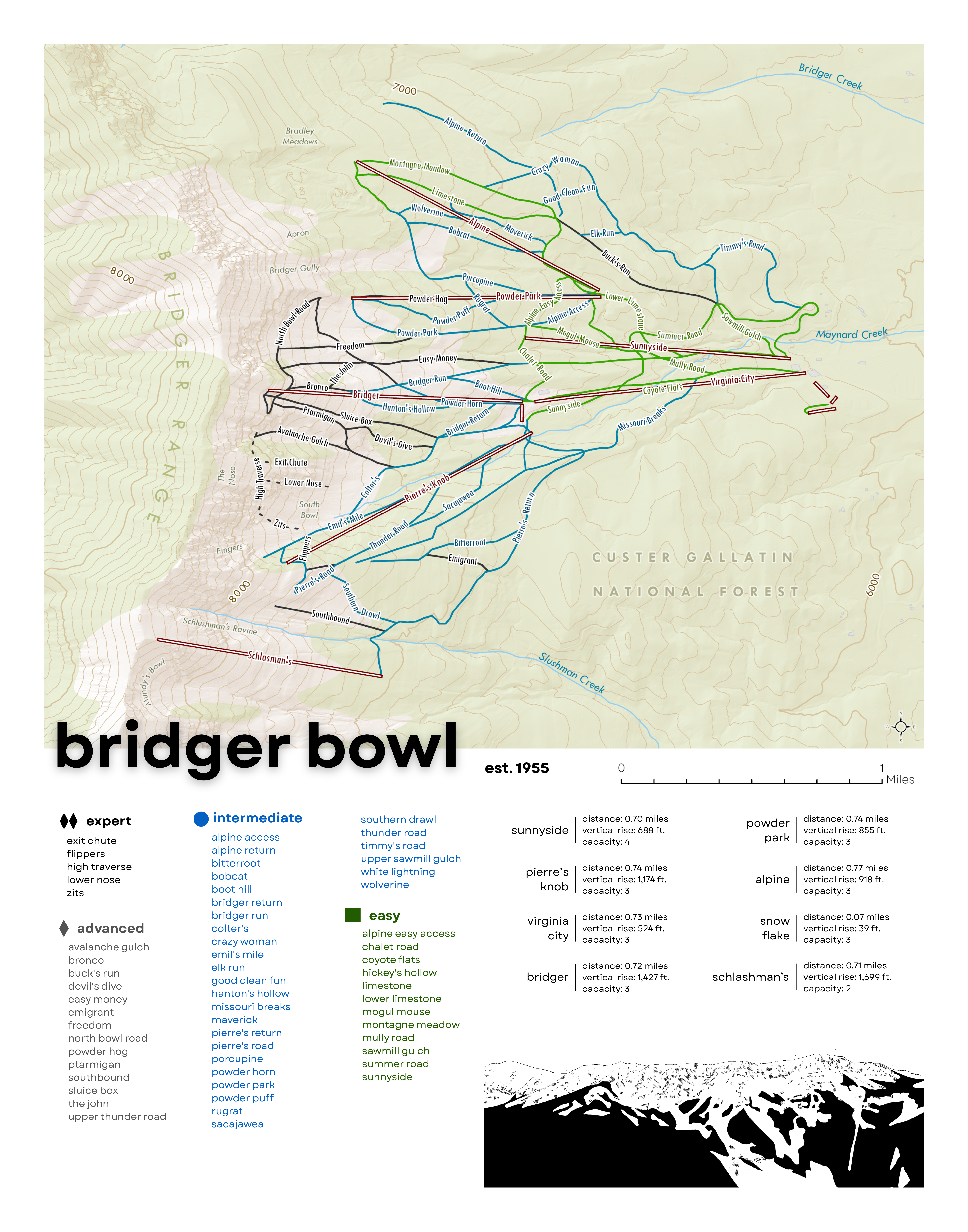
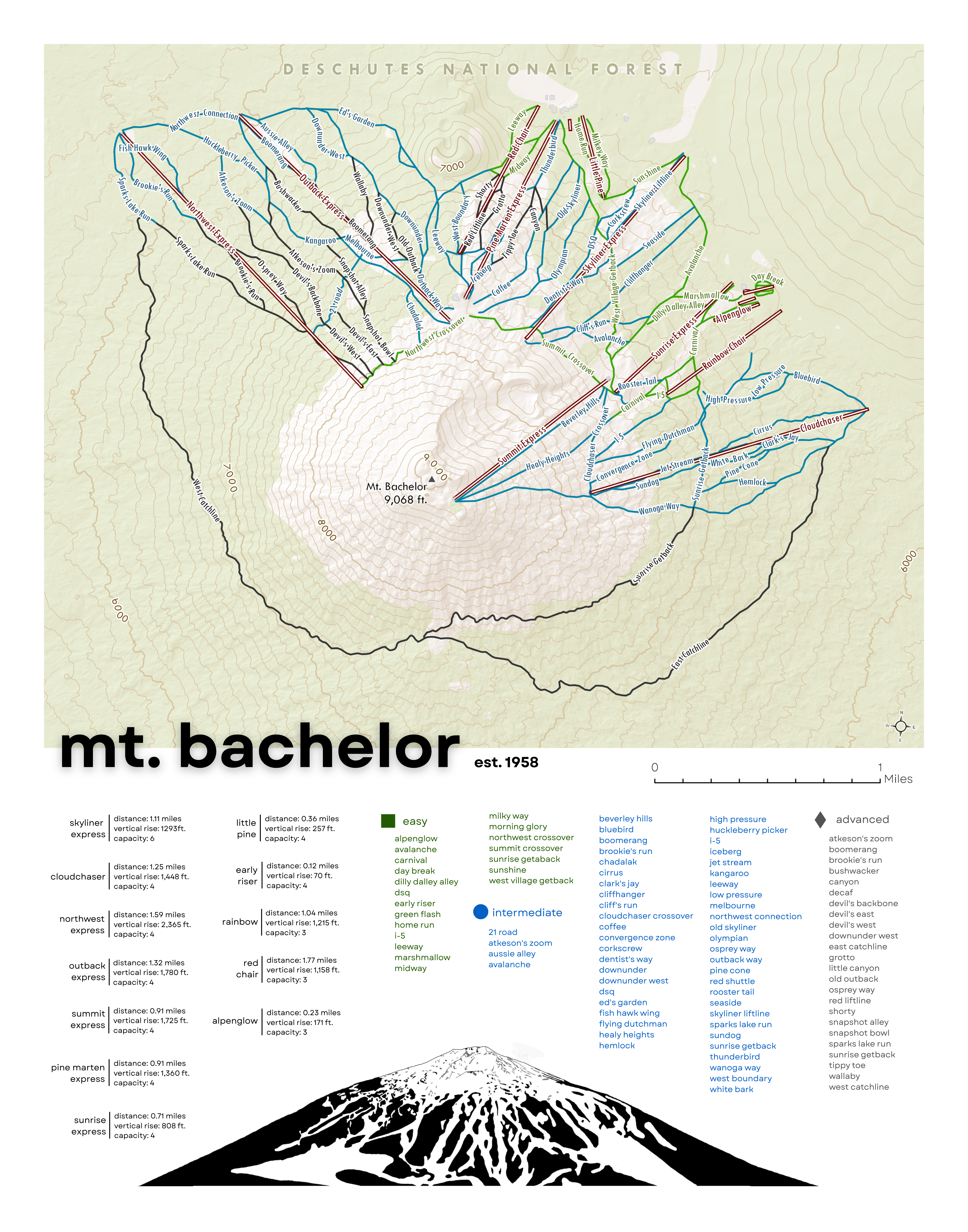
Ski Resort Maps
I create and sell these ski resort map posters in local shops in Steamboat Springs and on my Etsy shop. I continue to add more resorts to the collection.
Steamboat Resort Map
Breckenridge Resort Map
Bridger Bowl Resort Map
Mt. Bachelor Resort Map
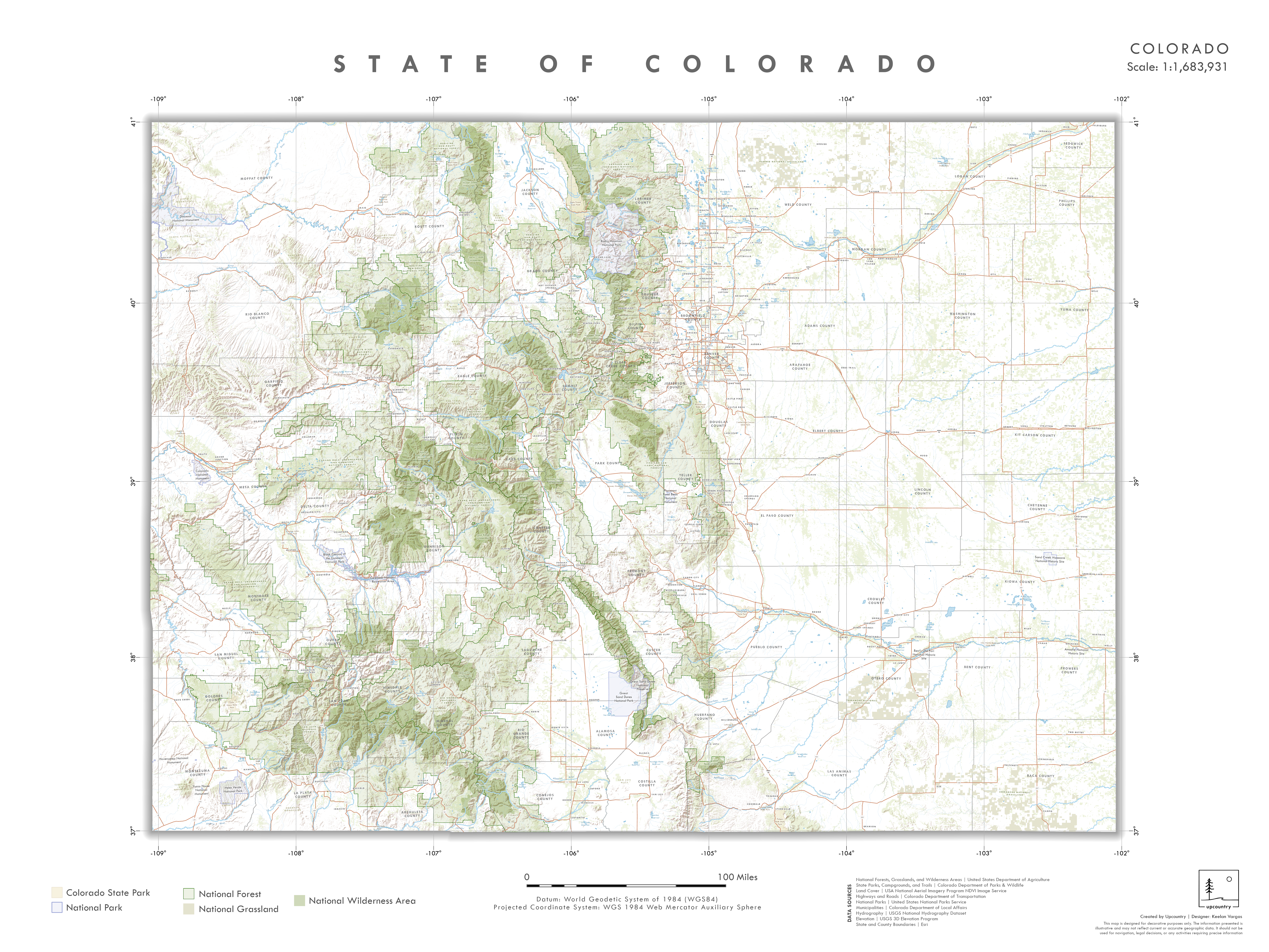
Statewide Basemap
During my postion at OIT, I created a custom basemap specific to the
State of Colorado. The goal was to provide a customized
basemap highlighting important reference layers around Colorado. The
basemap is free to use, and instuctions can be found in the
Colorado Statewide Basemap User Guide.
I symbolized the layers, set the labeling and visibility extents, and ensured that the
basemap provided a comprehensive cartographic reference for the state.
Documented Arborglyphs in Routt County, Colorado (1927-Present)
Approximate Locations of Arborglyphs, Routt County, CO
Western Colorado and Surrounding Region: Present Day
Historical Colorado County Boundaries and Railway Corridor
Principal Towns/Counties of Origin in New Mexico by Arborglyph Attribution
Principal Regions of Origin - Peruvian H-2A Sheepherders in U.S.
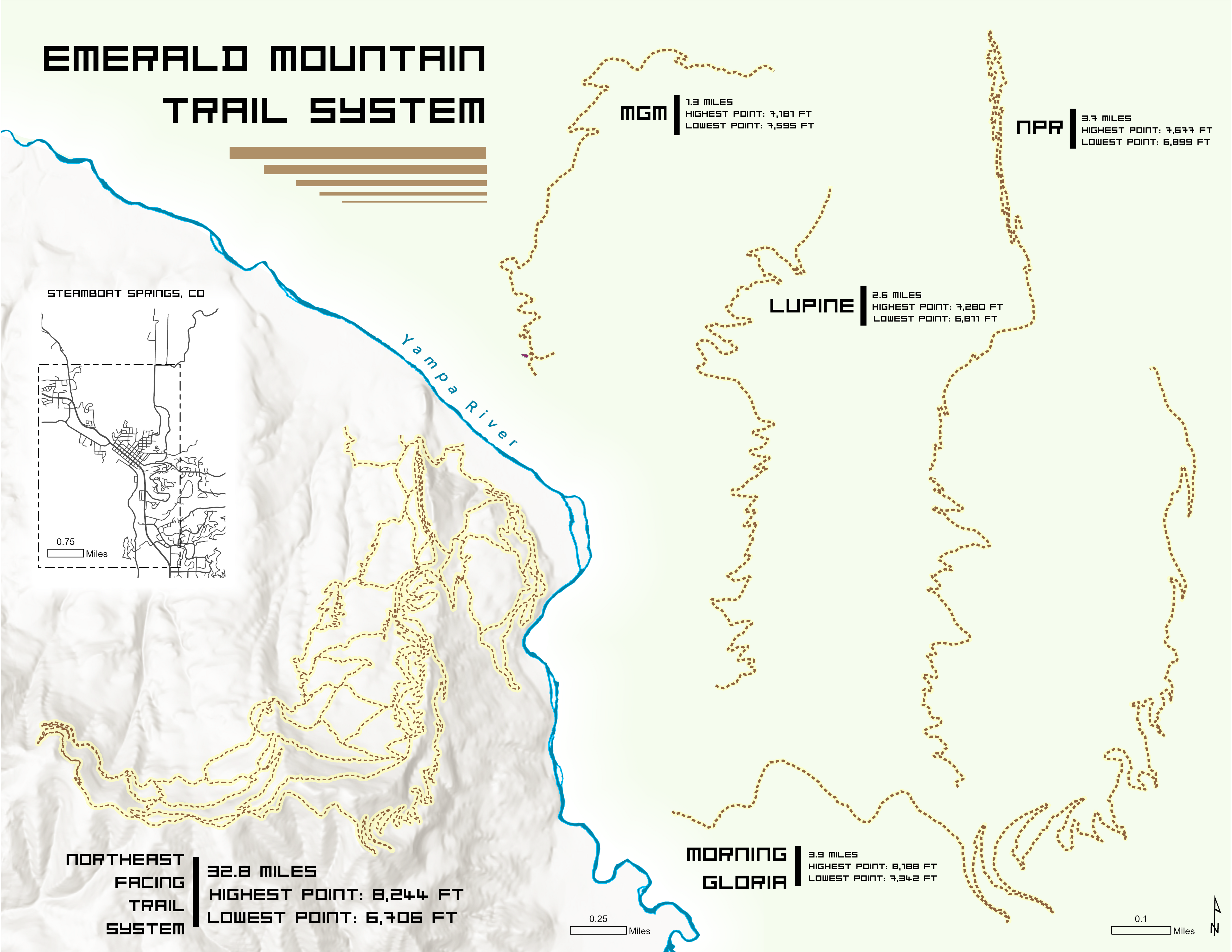
Emerald Mountain Trail System
I created this map as a gift for a friend illustrating their favorite trails on Emerald Mountain in Steamboat Springs, Colorado.
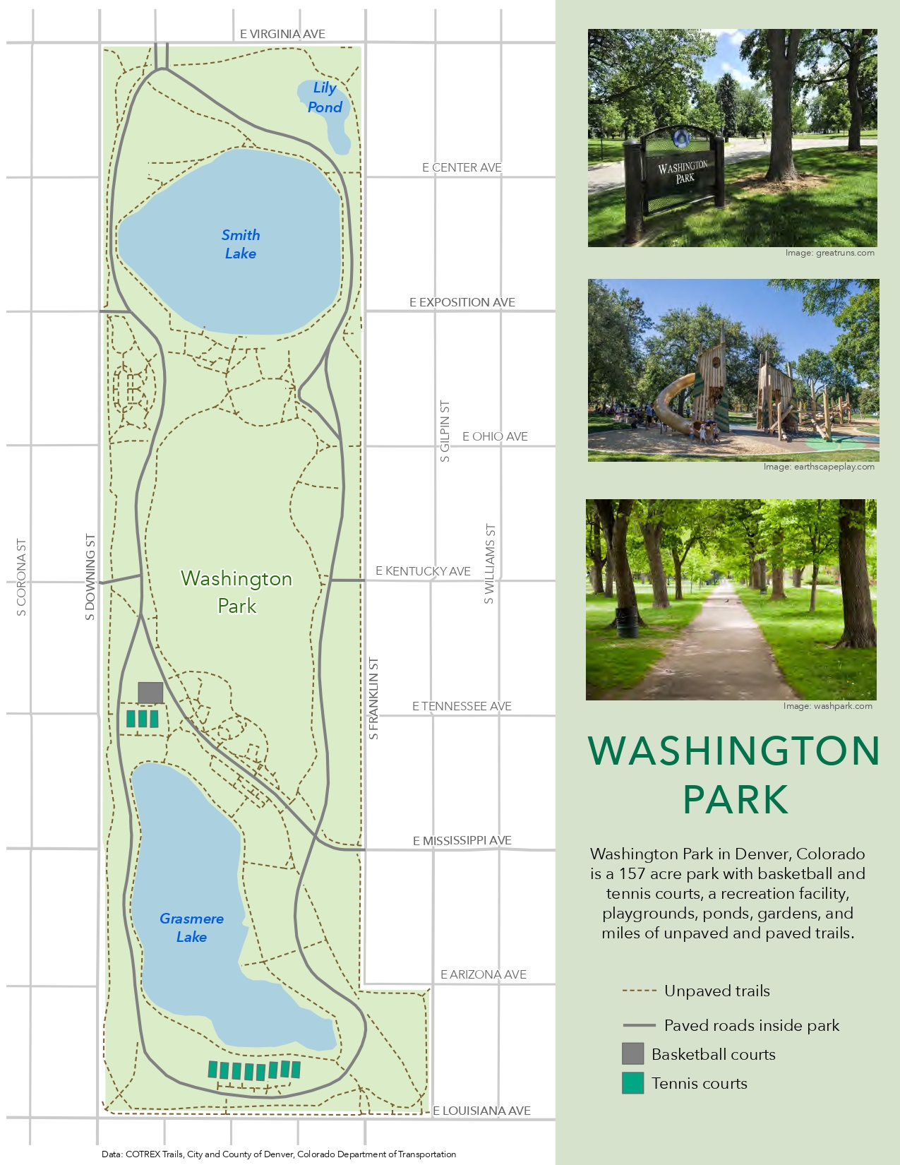
Washington Park, Denver, Colorado
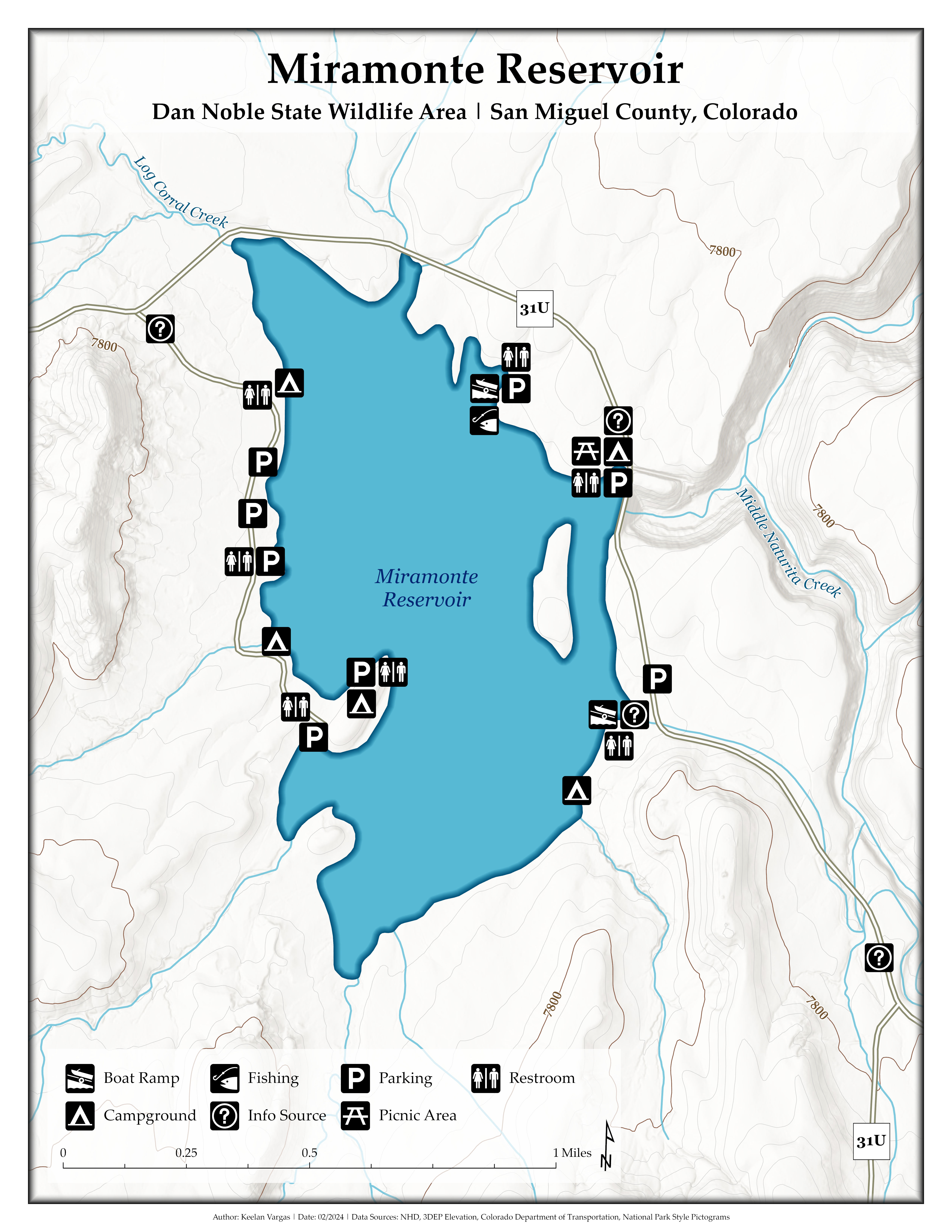
Miramonte Reservoir, San Miguel County, Colorado