The Aspen Archives
Lead GIS Research Assistant
2021 - Present
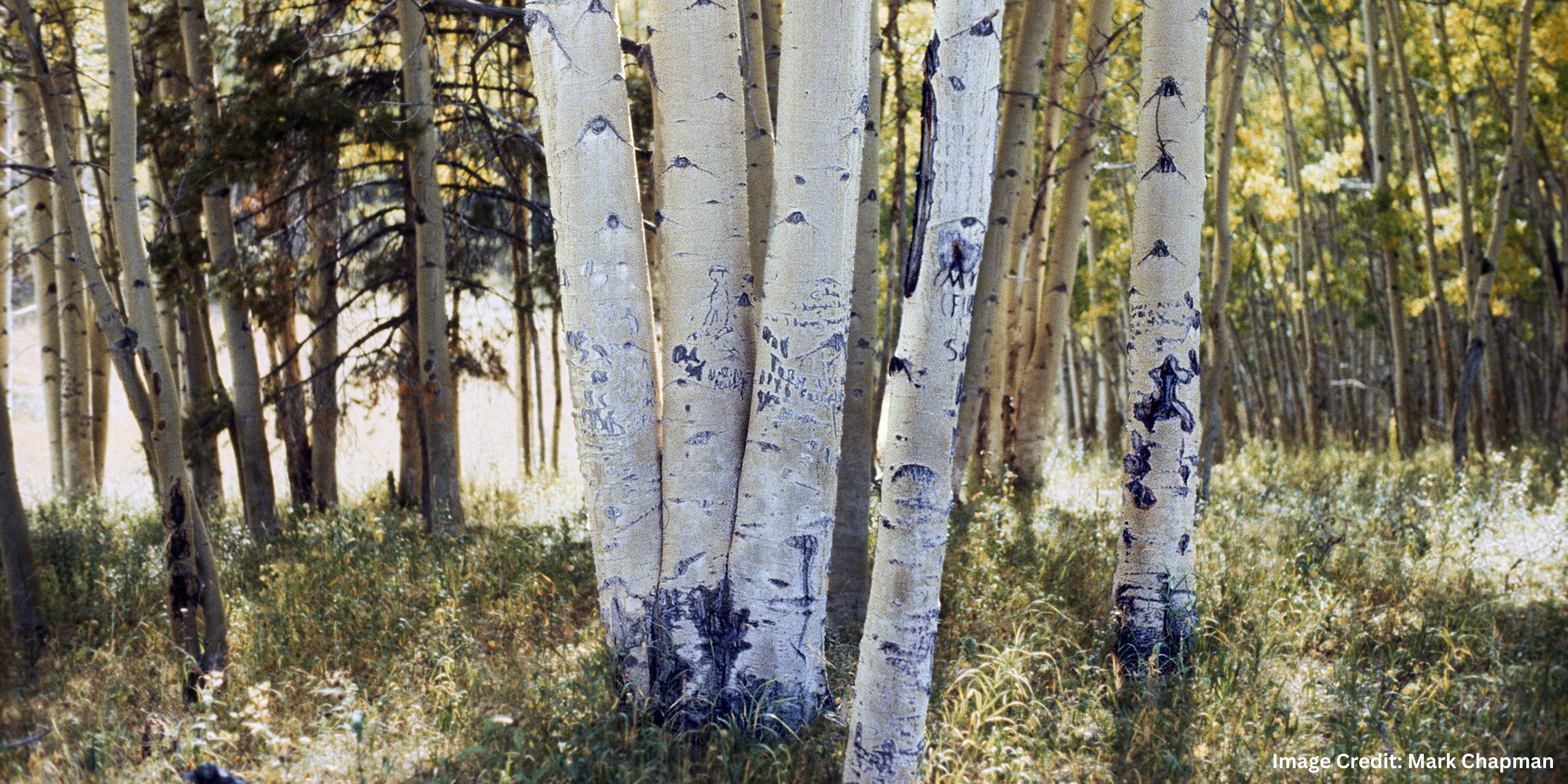
During the past forty years sheep ranchers in Colorado and the Western U.S. have become reliant on the expertise and labor of indigenous Peruvian Quechua herders participating in the US H-2A temporary agricultural worker visa program (Krögel, 2010). Echoes of these herders’ work in Routt County, Colorado remain in messages and symbols carved upon aspen trees located in the Medicine Bow-Routt National Forests. These carvings —known as arborglyphs—depict sheepherders’ experiences working on the open range and in high country forests, and serve as a blank slate for commentary about various topics such as religion, politics, or friendship. Research has been previously conducted on the significance of sheepherders’ use of arborglyphs to inscribe names, dates, regional origins, and commentary on herders lives (Mallea-Olaetxe, 2010). Furthermore, the paths and routes frequented by herders have been studied and dubbed “Sheepscapes”.
Arborglyphs in Routt County, Colorado
Dr. Alison Krögel is a professor in the Department of Spanish at the University of Denver where she teaches courses focused on Quechua and Andean literatures and cultures. She has been studying arborglyphs and the anthropological narratives they illustrate for over a decade and needed to add a spatial component to her research and exhibit
In 2020, Mark Chapman, a citizen scientist and resident of nearby Steamboat Springs, contacted the U.S. Forest Service and donated 180 photos of the glyphs that he has documented in the past thirty years. Digitizing and mapping Mr. Chapman’s images was crucial to the exploration of the historical and cultural significance of these sheepherders in Routt County.
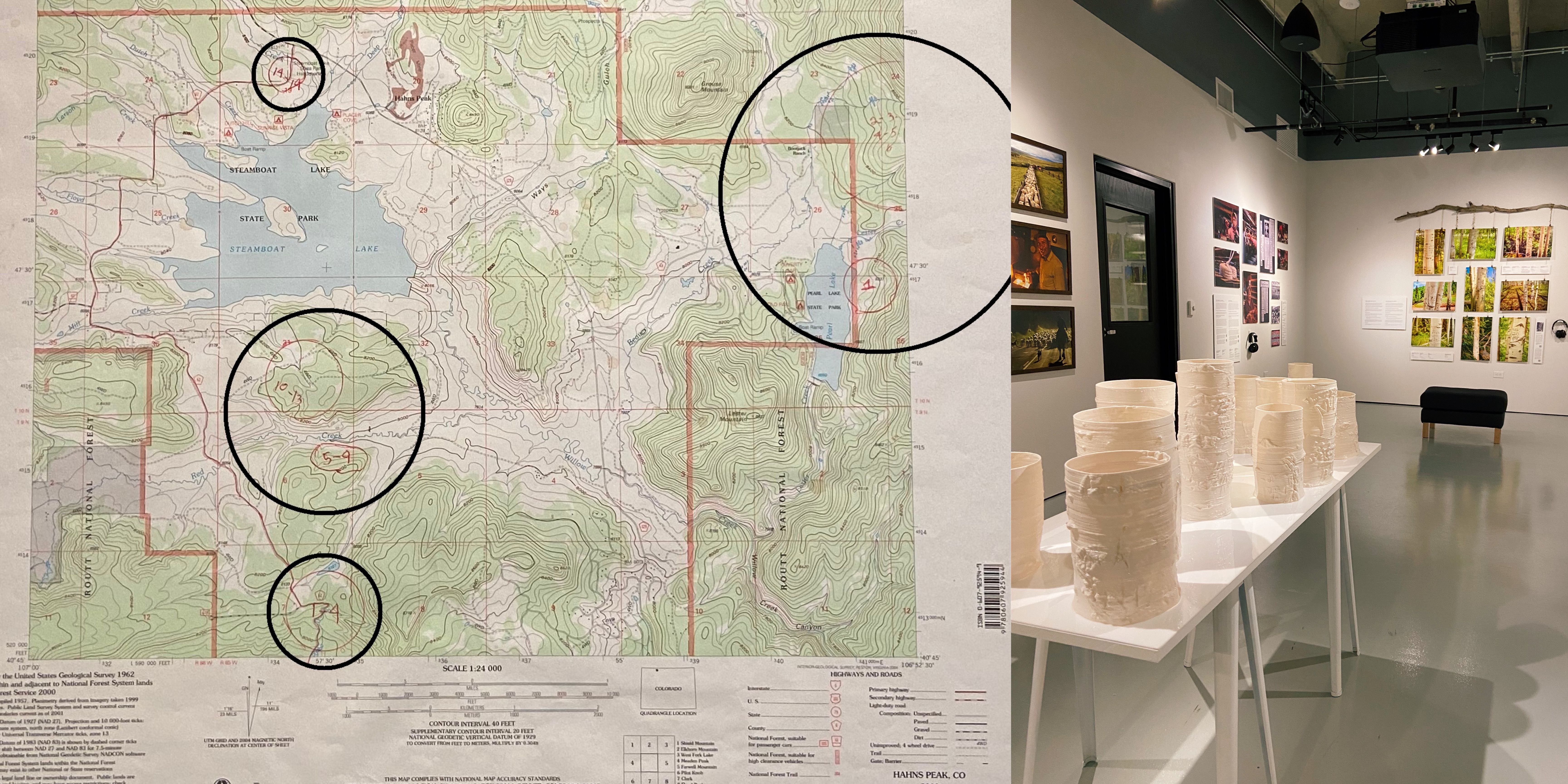
Left: USGS Topo Map with Mr. Chapman's annotations of general locations of arborglyphs near Steamboat Lake
Right: The Aspen Archives Exhibit at the University of Denver, Fall 2022
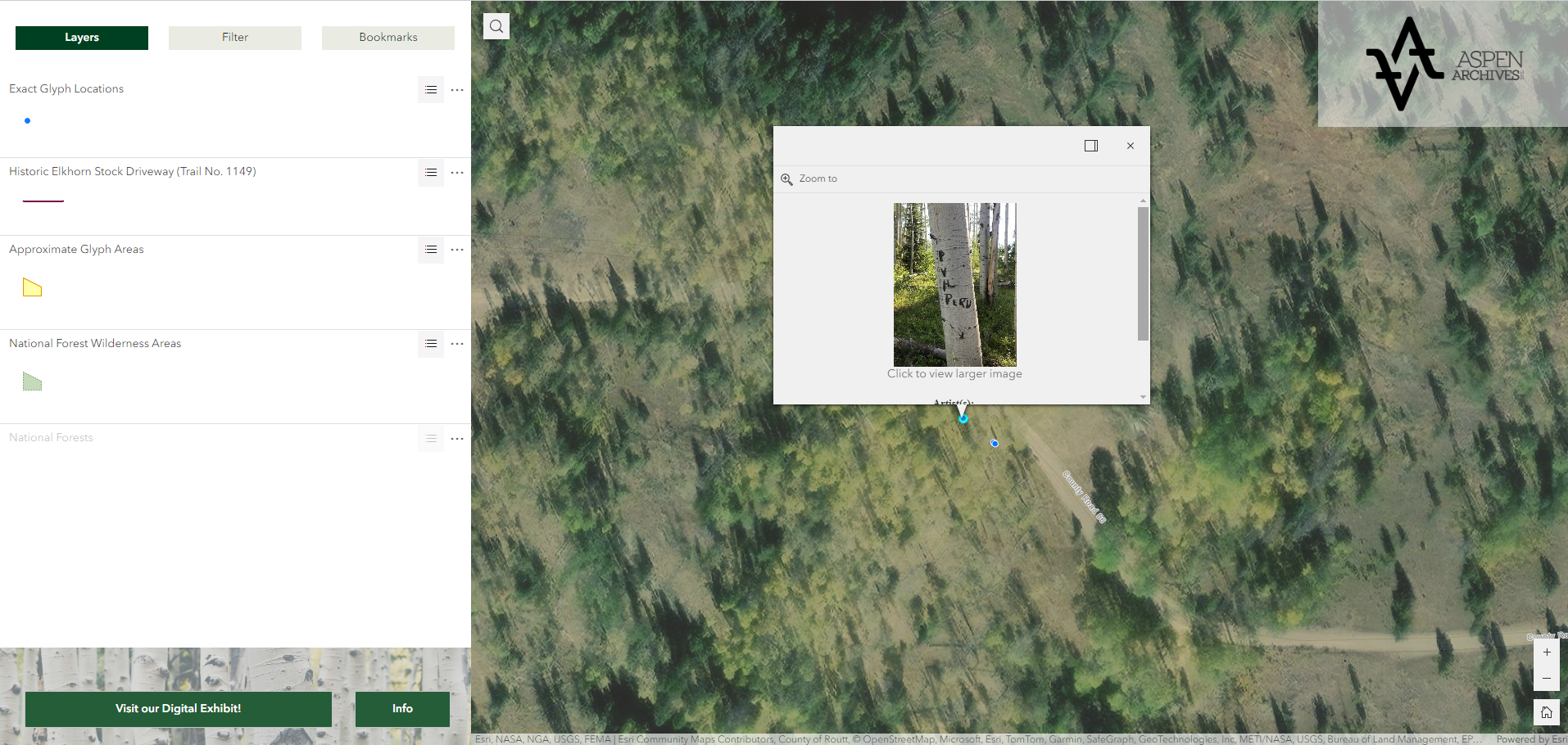
I have worked as the Lead GIS coordinator on this project since 2021. To start, I created two datasets to represent locations of arborglyphs. Part of the data exists as a polygon layer, digitized from areas where Mr. Chapman has documented arborglyphs on USGS Topo Quad maps in Routt County, CO. The other part of the data is a point layer of exact locations, derived from coordinate information from the images that Dr. Krögel has documented herself. Throughout the project, I have designed and built a geodatabase to store the locations of arborglyphs and their attributes, built a web application to display the locations of glyphs using the Esri Experience Builder platform, and put together the digital version of Dr. Krögel’s exhibit The Aspen Archives using Esri StoryMap Collections.
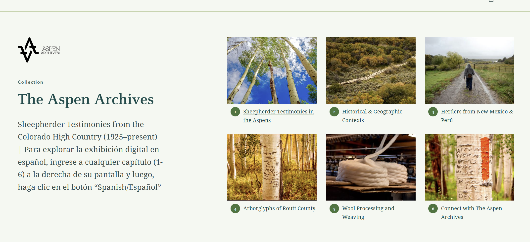
The digital Aspen Archives exhibit uses Esri StoryMap Collections to tie together six different StoryMaps that explore Dr. Krogel's research on arborglyphs and sheepherding history in Colorado.